


When the Earth Loses Its Balance
There are moments when nature rewrites its own rules. A hill that slowly begins to slide, a mountainside that suddenly breaks loose, or a valley that turns into a roaring mudflow – landslides show us how alive and changeable our planet is. They affect not only distant mountain regions but also areas closer to home, where extreme rainfall and human activity upset the natural balance.
In recent years, the earth seems to be moving more often. Intense downpours, melting permafrost, and deforestation are all making slopes less stable. In this article, we explore the world of landslides – what they are, why they happen, how they affect our environment, and what role climate change plays in them.
What Is a Landslide?
A landslide is the sudden movement of soil, rock, or debris down a slope. Sometimes it happens slowly – barely noticeable – and sometimes with tremendous speed, like a mudflow after heavy rain. Gravity constantly pulls on the earth, but only when the soil’s resistance becomes too weak does the material start to slide.
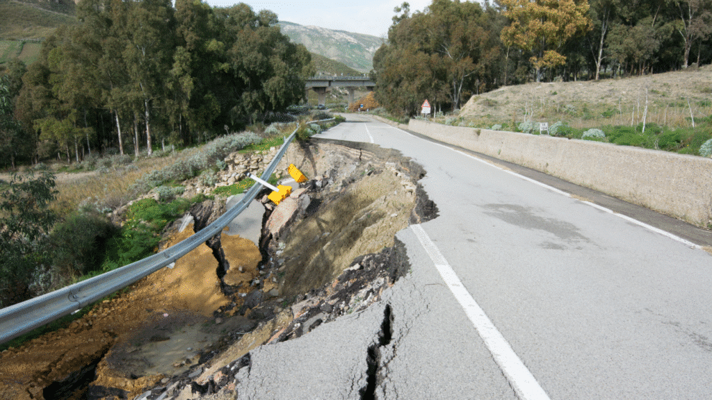
There are several types of landslides. A rockfall occurs when stones or blocks break loose and tumble down. A slump involves a larger mass of soil moving as a single unit along a slip surface. Mudflows are mixtures of water, earth, and debris that flow downhill like a liquid. And then there’s soil creep, a slow but steady movement that can gradually damage buildings and roads.
Why the Ground Starts to Move
Most landslides begin with water. Heavy rainfall saturates the soil, increasing the pressure between soil particles and reducing their cohesion. Once the ground becomes too heavy or too wet, it gives way. Earthquakes can also suddenly set slopes in motion: the vibrations reduce friction between soil layers and trigger weak points.
But not everything is natural. Humans play an increasingly large role. Deforestation removes root structures that hold the soil together. Road construction, mining, and poorly planned building disrupt natural drainage patterns. Even irrigation, if poorly managed, can destabilize a slope. This is causing line between natural and human causes to become increasingly blurred.
The Consequences of a Shifting Earth
The impact of landslides is often devastating. Houses disappear, roads become impassable, and entire villages can be cut off from the outside world. The economic damage runs into the millions, but the human toll is often immeasurable. Beyond physical destruction, landslides cause long-term disruption, people lose their homes, their safety, and their sense of future.
The landscape itself changes as well. A slide can block rivers, and this can suddenly create new lakes or causing floods downstream. Ecosystems are disturbed, animals lose their habitats, and farmland can become unusable for years. The earth redraws itself, often leaving permanent scars.
Climate as a Catalyst
Climate change makes slopes more vulnerable. As the planet warms, extreme weather events become more frequent. Short, intense rainstorms saturate the soil faster. In mountain regions, permafrost, the frozen rock that for centuries acted as glue between boulders, is melting, leaving entire mountainsides unstable.
Vegetation patterns are shifting too. In some regions, trees die off due to drought or wildfires, while in others, new species take root that don’t anchor the soil as well. Along the coast, rising sea levels undermine cliffs, leading to coastal erosion and collapses. Nature is changing its rules, and humanity must adapt.
Can We Prevent Landslides?
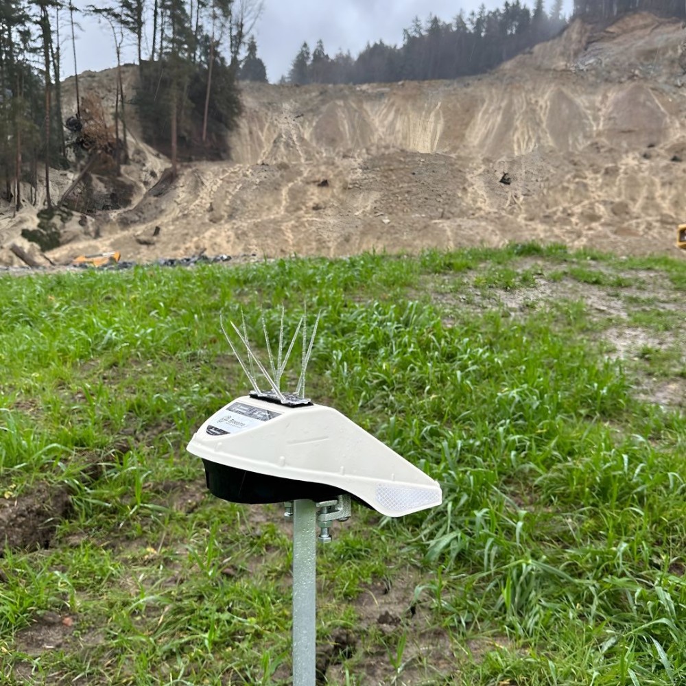
We can’t prevent them entirely, but we can reduce the risk. Engineers stabilize slopes with retaining walls, drainage systems, and vegetation. In vulnerable regions, building restrictions are imposed or revised. Technology also helps satellites and sensors detect minute movements in the earth and can warn of impending disasters.
Increasingly, local residents are involved in monitoring. In villages across the Alps, Andes, and Asia, people are learning to recognize warning signs, small cracks in the ground, cloudy water in streams, or tilting trees. Prevention begins with awareness, not just technology.
A Lesson in Humility
Landslides remind us that the earth is alive and in motion. They reveal the thin line between stability and chaos, between control and surrender. We can measure, plan, and reinforce, but in the end, nature remains the director. What we can do is listen to its signals and act wisely with the space we occupy.
Those who understand why the earth sometimes literally loses its balance learn not only how to prevent disasters, but also how to live more harmoniously with nature itself.
Curious how landslide monitoring works in practice? Read our case study: Landslide Monitoring Höbranz, Vorarlberg, Austria.


