

Automated Monitoring of Landslides and Slope Movements
Monitor three-dimensional displacements of slopes and embankments continuously and remotely. Detect changes early and support risk assessments with up-to-date measurement data.
✓ Automated measurements
✓ Data instantly available
✓ Continuous 3D displacement measurements

WHY LANDSLIDE MONITORING?
Early insight reduces risks
Landslides can pose serious risks to people, infrastructure and the environment. Continuous monitoring helps detect changes earlier and supports better-informed mitigation measures.
Safety of people
Detect changes early and reduce risks for residents, road users and employees.
Protection of infrastructure
Monitor slopes near roads, railways, buildings and other vulnerable assets.
Environmental protection
Limit damage to ecosystems, waterways and surrounding natural areas.
Cost control
Prevent unexpected repair costs, delays and prolonged downtime.
Well-informed decision-making
Use up-to-date measurement data for risk assessments, inspections and mitigation measures.
HOW DOES IT WORK?
From slope movement to up-to-date insight

Installation
Locator One is installed on or near the slope on a stable foundation or survey pillar.
Automatic Measurement
Locator One takes measurements according to the configured measurement interval. The data is transmitted automatically.
Data Analysis
The measurement data is transmitted and processed automatically. In Parvamoti, you can view trends, displacements, system status and potential deviations.
WHAT YOU CAN MONITOR
Continuous 3D insight into slope movement
- Horizontal displacement along the X and Y axes
- Vertical displacement along the Z axis
- Movement speed
- Trend development
- Deviations compared with previous measurements
- Remote system status

“Locator One gives us valuable insight into the movement of the landslide. It helps us monitor the surrounding area and keep the situation under control.”
LANDSLIDE MONITORING IN PRACTICE
Projects that make a difference
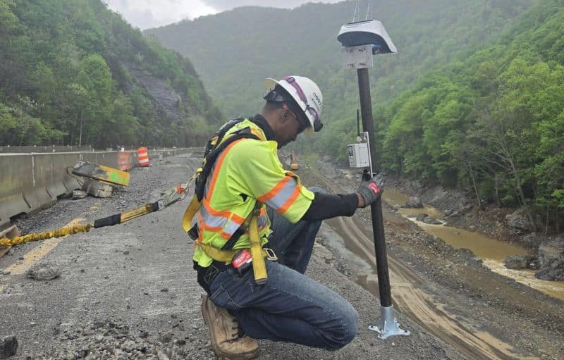
Landslide Monitoring, I-40, Asheville, North Carolina, United States
Landslide Monitoring
Project duration: May 2025
Objective: The area was affected by active slope instability and the risk of sudden ground movements that could impact road safety.
Solution: Along the landslide-prone I-40 corridor near Asheville, 104 Locator One devices were installed. Continuous remote monitoring gave the client direct insight into ground movements, enabling timely road closures and significantly reducing liability risks.
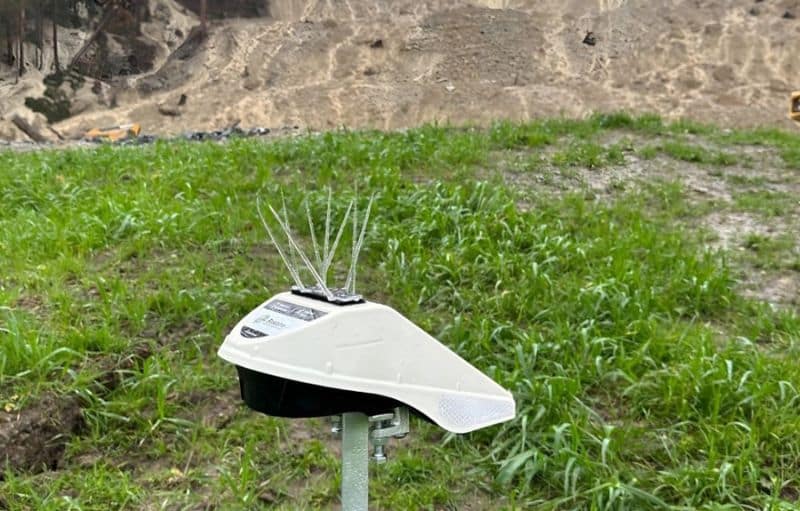
Landslide Monitoring, Hörbranz, Austria
Landslide Monitoring
Project duration: November 2023 – present
Objective: A continuously moving landslide required reliable detection of ground displacement to support safe stabilisation measures.
Solution: The deployment of Locator One devices enabled continuous GNSS-based monitoring of slope movement. Displacements were detected early, supporting well-informed decision-making, improving safety and reducing risks to people and property.
Strengthening Your Sector Together
Locator One is designed for temporary, high-precision monitoring in dynamic construction environments. Typical applications include:
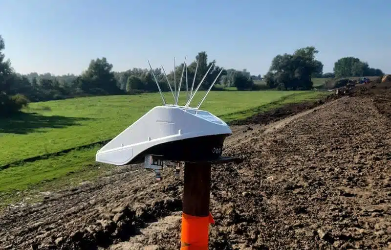
Zakbakenmonitoring
Geïnstalleerd op zakbaken of nabijgelegen constructies volgt de Locator One verticale bewegingen en bodemverdichting over tijd. De geïntegreerde radarsensor maakt nauwkeurige metingen van ophooglagen en restzetting tijdens ophoogwerkzaamheden mogelijk.

Waterpeilmonitoring
Met behulp van geïntegreerde radarafstandsmetingen kan de Locator One continu het oppervlaktewaterpeil in kanalen, rivieren en bassins monitoren.

Monitoring van grondbeweging
De Locator One monitort grondbeweging tijdens grondwerkzaamheden en ontgravingen. Zo kunnen projectteams onverwachte verplaatsingen vroegtijdig signaleren en grip houden op de situatie op de bouwplaats.

Monitoring van aardverschuivingen en taludstabiliteit
De Locator One monitort taluds vóór en na aardverschuivingen en biedt continu inzicht in driedimensionale verplaatsingen. Dit ondersteunt risicoanalyses en het nemen van passende beheersmaatregelen.