Basetime: Precision Geodetic Solutions - Unlocking Excellence in geodetic data and tunnel construction.
Locator One meets key international standards.
Locator One is designed to deliver reliable, actionable monitoring supported by key international certifications such as CE, FCC, and UKCA. With an IP65 rating and RoHS compliance, it performs consistently in demanding environments while meeting safety, regulatory, and sustainability standards. These certifications not only simplify deployment across regions but also give teams confidence that they are working with safe, dependable equipment, helping create safer living and working environments.

At Basetime, we believe monitoring is only valuable when it leads to action. That’s why Locator One is built not just for precision, but for trust, delivering reliable data that teams can act on with confidence around the world.

To support this, Locator One meets key international certifications, including CE, FCC, and UKCA. The CE marking confirms compliance with European safety, health, and environmental requirements, helping customers move faster through procurement and approval processes in EU projects. FCC certification ensures the device meets electromagnetic standards for use in the United States, reducing the risk of interference issues or regulatory delays. The UKCA mark demonstrates conformity with UK regulations, allowing customers to deploy the system in UK projects without additional compliance steps.


CE certification mark showing that Locator One device is certified
CC certification mark shows Locator One is certified
UKCA conformity mark shows Locator One is compliant

Locator One also carries an IP65 rating, protecting it against dust and water. This supports reliable performance in harsh outdoor environments, reducing maintenance needs and limiting data gaps during real-world monitoring conditions.

In line with our commitment to sustainable innovation, Locator One is RoHS compliant, limiting the use of hazardous substances. This helps customers meet environmental requirements and sustainability standards that are increasingly part of infrastructure and monitoring projects.

IP65 ingress protection rating shows Locator One is certified
RoHS compliance mark shows Locator One is compliant with RoHs certification

These certifications are more than technical labels, they directly support our customers in deploying Locator One with confidence, across regions and in demanding environments. By combining certified hardware with automated processing, clear dashboards, and instant alerts, we help teams move from data to decisions, quickly and safely.

And of course, it also feels better knowing that you and your colleagues are working with safe, reliable equipment. Without that assurance, we at Basetime cannot truly support safer living and working environments.

Want to learn how Locator One can support your project?
Get in touch with our team to speak with an industry expert and discover how we can help you monitor with confidence in any environment.
Contact us to speak to an expert
Explore Locator One

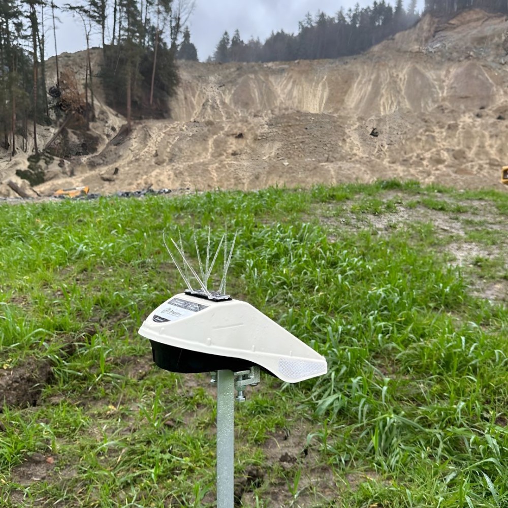
Basetime’s GNSS device installed on the slope for Hörbranz landslide monitoring, capturing displacement data to support early detection.
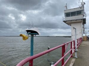
Basetime Locator One device monitoring structural deformation on Haringvliet Bridge during deck replacement in Numansdorp, Netherlands.

Read more?

What’s new in Parvamoti? Part 3 of 3: View Movement Parallel and Perpendicular to Your Asset

For Object Monitoring projects, movement can now be viewed in relation to the actual direction of the asset.

By defining the Angle Linear Asset, Parvamoti can visualise displacement parallel and perpendicular to the structure, making it easier to understand whether movement is occurring along or across bridges, railways, roads and other linear assets.

A clearer way to interpret movement. More context for your monitoring data.

Lees meer

Part 3 of 3: View Movement Parallel and Perpendicular to Your Asset

INTERGEO 2026 recap: three days of monitoring in Munich

INTERGEO 2026 is a wrap!
We had three great days in Munich, meeting people from across the geospatial and monitoring industry and talking about projects, monitoring challenges and the possibilities of automated GNSS monitoring.

A big thank you to everyone who stopped by the Basetime booth.

Lees meer

barry, erik, martijn, koen en luna op intergeo 2026 in munchen

Introducing Alerts in Parvamoti

Monitoring shouldn’t mean continuously checking a dashboard to see whether something has changed.

With Alerts in Parvamoti, users can define relevant movement conditions and automatically notify the right people by email, SMS or both when those conditions are met.

That means less time spent manually checking monitoring dashboards, greater oversight of changing conditions and more focus on what happens next.

With the latest Alerts V2 update, we’ve expanded this functionality with more precise device targeting, new movement comparison options, clearer threshold guidance and a simpler configuration flow.

It’s another step towards our goal of making Parvamoti a more proactive monitoring platform, moving from reliable monitoring data towards timely information and action.

In our latest newsletter, we introduce Alerts in Parvamoti and take a closer look at what the new functionality offers.

Lees meer

alerts in parvamoti

What’s new in Parvamoti? – Part 2 of 3: Understand settlement relative to your project baseline

In the second part of our Parvamoti update series, we’re highlighting the 𝗥𝗲𝗹𝗮𝘁𝗶𝘃𝗲 𝗦𝗲𝘁𝘁𝗹𝗲𝗺𝗲𝗻𝘁 𝘃𝗶𝗲𝘄 𝘄𝗶𝘁𝗵𝗶𝗻 𝘁𝗵𝗲 𝗦𝗲𝘁𝘁𝗹𝗲𝗺𝗲𝗻𝘁 𝗥𝗼𝗱 𝗱𝗮𝘀𝗵𝗯𝗼𝗮𝗿𝗱.

This allows users to analyse soil level and ground plate height relative to the initial project baseline, making it easier to follow settlement development and recognise movement trends over time.

The dashboard also brings these measurements together visually, with the option to review individual measurements, averaged values and export the data for further analysis.

Read Part 2 to learn more about how Relative Settlement provides clearer context for settlement monitoring.

Lees meer