

Basetime Accessories & Credits Explained: A Complete Guide to Optimizing Your Setup
To get the most out of your Basetime solutions, it’s not just about the hardware itself, it’s about how you install, support, and use it. The Basetime webshop offers a focused range of accessories and credit packages to ensure your monitoring setup is accurate, reliable, and flexible.
In this guide, we’ll walk you through all currently available products, explaining what they are, how they are used, and why they matter.
The Foundation of Accurate Monitoring
For GNSS-based monitoring systems, stability is critical. Even the smallest movement in a reference station can affect measurement accuracy. That’s why choosing the right mounting solution is essential.
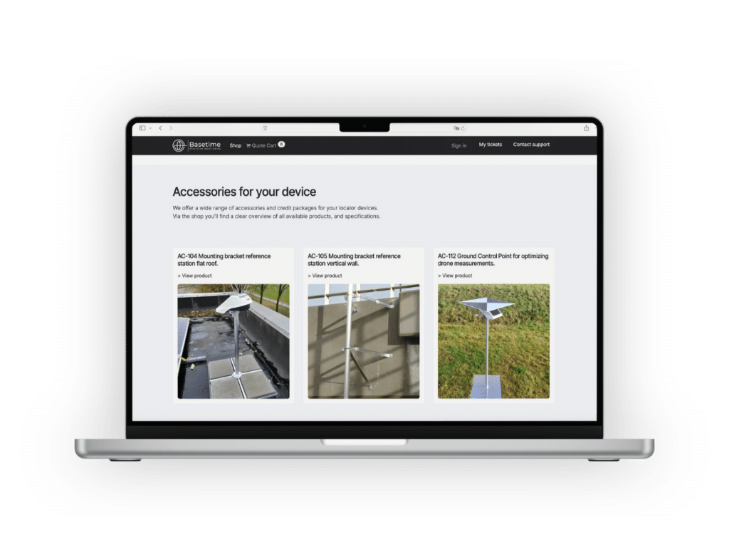
AC-104 Mounting Bracket – Flat Roof Installation
The AC-104 mounting bracket for flat roofs is designed for installing reference stations on horizontal surfaces such as rooftops.
What it does
It provides a stable, fixed base that keeps your reference station securely in place. This is particularly important in environments exposed to wind, weather, or vibration.
When to use it
- On flat roofs of buildings or site cabins
- In open environments with a clear sky view
- For long-term or semi-permanent installations
Why it matters
A well-positioned and stable reference station enable consistent and accurate measurement data over time.

AC-105 Mounting Bracket – Vertical Wall Installation
The AC-105 mounting bracket for vertical walls is designed for situations where roof installation is not possible or practical.

What it does
This bracket allows you to securely mount a reference station to a vertical surface, such as a wall or structure, while maintaining proper positioning.
When to use it
- In urban or restricted environments
- On infrastructure such as bridges, quay walls, or buildings
- When roof access is limited
Why it matters
It provides flexibility in installation without compromising stability, ensuring your monitoring setup remains reliable and accurate even in constrained spaces.
Ground Referencing: Improving Measurement Accuracy
Beyond mounting, accurate positioning also relies on proper reference points.

AC-112 Ground Control Point (GCP)
The AC-112 Ground Control Point is used to improve measurement accuracy by providing a fixed reference on the ground.
What it does
A ground control point is a clearly marked location with known coordinates. It is used to align and validate measurement data, especially when combining data from multiple sources.
When to use it
- Drone mapping and photogrammetry
- Construction site monitoring
- Calibration and validation of measurement data
Why it matters
By introducing fixed reference points, you significantly improve the accuracy and consistency of your data. This is especially important in projects where precision is critical.
Credit Packages: Powering the Pay-Per-Measurement System
In addition to physical accessories, Basetime uses a Pay-Per-Measurement (PPM) system powered by credits. This flexible model makes sure you only pay for what you actually use.
How It Works
Instead of a fixed subscription, you purchase credits that are consumed each time your device performs a measurement. Each measurement includes:
- Data collection
- Data transmission
- Processing and calculations
- Data storage
- Visualization within the platform
This means there are no costs for inactive devices, giving you full control over your usage and budget.
Available Credit Packages via the Basetime Webshop
Basetime offers a range of credit bundles to suit different project sizes and usage levels. Current packages include:
- 6,000 credits (CR-006)
- 12,000 credits (CR-012)
- 24,000 credits (CR-024)
- 36,000 credits (CR-036)
- 48,000 credits (CR-048)
- 60,000 credits (CR-060)
These packages allow you to scale your monitoring setup depending on your needs.
Cost Efficiency and Flexibility
Larger credit packages generally provide better value per measurement, making them ideal for long-term use. At the same time, smaller packages allow for a lower entry point and maximum flexibility.
This scalable approach makes the system suitable for a wide range of industries, including construction, infrastructure, and surveying.
In Summary: Choosing the Right Setup
To optimize your Basetime system, it’s important to combine the right accessories with the appropriate credit package.
- Need a stable rooftop installation? – Choose the AC-104
- Working in a constrained environment? – Use the AC-105
- Require high-precision validation? – Add the AC-112 Ground Control Point
- Want full control over usage costs? – Select a credit package that matches your project
Ready to Get Started?
Would you like to explore the available accessories and credit packages in more detail? Visit the webshop and find the right products for your setup:
https://www.webshop.basetime.nl
Do you need advice tailored to your project or industry? Our experts are here to help. Get in touch via our main website and speak directly with a specialist:
https://basetime.nl/en/


