

Automated Dike Monitoring for the RHESI Project
Alpine Rhine Valley, Austria and Switzerland
The RHESI project combines flood protection with the ecological restoration of the Alpine Rhine. Gravel extraction and construction activities associated with the renaturation programme can influence settlement and horizontal movement of the surrounding flood protection dikes.
To monitor these movements, Rheinunternehmen deployed 178 Locator One monitoring points, supported by a project-specific GNSS reference station. The autonomous network provides repeatable 3D position measurements at configurable intervals while reducing the need for recurring manual survey campaigns.
Locator one units
measurements per day
DISPLACEMENT MONITORING
Monitoring Settlement and Horizontal Dike Movement
During the renaturation works, gravel is extracted from sections of the Alpine Rhine. Changes in ground conditions can result in settlement and horizontal displacement of the adjacent flood protection dikes.
Because even relatively small changes may be relevant when assessing dike behaviour, Rheinunternehmen required a monitoring method capable of delivering repeatable measurements across a large number of locations.
Traditional monitoring methods, such as periodic total-station surveys or manual GNSS measurements, would require surveyors to repeatedly visit the monitoring profiles and would provide a considerably lower measurement frequency.
Following an extensive evaluation and testing process, Rheinunternehmen selected Locator One for autonomous monitoring.
RHESI Monitoring Setup
The RHESI monitoring network combines autonomous GNSS measurements, a project-specific reference station and remote data processing in Parvamoti.
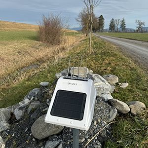
A total of 178 Locator One systems are installed across the flood protection dikes, providing frequent measurements while reducing recurring fieldwork.
A network of 178 GNSS sensors automatically records movements across the dike system.
Remote measurements reduce the need for time-consuming manual surveying and recurring site visits.
Predefined thresholds and automated alerts help the project team respond quickly when unexpected movement is detected.
Autonomous Field Operation
Solar power and integrated mobile connectivity eliminate the need for external power, cabling or a local communication gateway.
Parvamoti Platform
Measurement data from the complete monitoring network is processed and made available in one central environment for analysis and project-wide review.
Project-Specific GNSS Reference
A nearby GNSS reference station provides correction data for the monitoring network, supporting consistent and precise positioning across the project area.
178 Monitoring Points
Locator One systems are installed in monitoring profiles along the flood protection dikes to track settlement and horizontal movement.
Flexible Measurement Frequency
Measurement intervals can be adjusted remotely, with up to 96 GNSS measurements per day when closer monitoring is required.
Installation & Commissioning
Landmark supported Rheinunternehmen with installation, commissioning and training in the use of Parvamoti.
Smarter monitoring at the Alpine Rhine
See the RHESI Monitoring Project in Action
Discover how Rheinunternehmen, Landmark and Attenberger use 178 Basetime Locator One devices to monitor the flood protection dikes along the Alpine Rhine.
The video provides a closer look at the RHESI project, the installation of the monitoring network and the role of automated GNSS measurements in supporting safe and efficient flood protection.
“The combination of reliability and ease of use makes the Locator One our first choice for future projects as well.“
Automated Data Processing and Alerts
Measurement data is transmitted automatically through the integrated mobile connection and processed in the Basetime environment before the results are made available in Parvamoti.
Measurement
Locator One performs the scheduled GNSS measurement.
Transmission
Data is sent automatically through the integrated mobile connection.
Processing
Measurement data is processed and stored in the Basetime environment.
Visualisation
Results are displayed in Parvamoti for analysis of individual monitoring points and long-term trends.
Alerts
Configured warning and alarm thresholds can trigger notifications when defined limits are exceeded.


Environmental Context for Movement Analysis
In addition to GNSS positioning, Locator One records temperature data.
Temperature measurements provide additional context when interpreting position data. By comparing movement trends with daily and seasonal temperature variations, the project team can investigate whether observed patterns coincide with environmental changes.
Long-term datasets help identify recurring behaviour and highlight changes that may require further geotechnical assessment.
Radar-Based Water-Level Monitoring
Locator One also contains a radar sensor that can measure the distance between the device and the surface below.
For RHESI, this creates the possibility of using selected monitoring points for water-level measurements during future flood events. This capability is additional to the GNSS-based deformation monitoring and can be used where the installation geometry is suitable.
Flexible Deployment When Conditions Change
Because Locator One is self-contained and wireless, individual systems can be temporarily relocated when project conditions require it. Historical measurements remain available in Parvamoti, allowing the original monitoring history to be retained.


Project Outcomes
Remote operation of 178 monitoring points
Measurements can be collected without visiting every monitoring location for each survey round.
Reduced field infrastructure
Solar power and mobile connectivity remove the need for local power, cabling and gateways.
Higher measurement frequency
Measurement intervals can be increased when closer observation is required.
Configurable alerts
Warning and alarm thresholds support targeted review of relevant movements.
Centralised monitoring data
Measurements from the complete network are available within one Parvamoti environment.
Reduced recurring fieldwork
Automated measurement rounds reduce the personnel capacity required for repeated manual surveys.
Other Applications
Beyond dike monitoring, the system can be applied to other critical public infrastructure, such as dams, tunnel entrances, bridges, and various other assets. The sector must embrace digitization and automation to address large-scale infrastructure challenges efficiently, sustainably, and within available resources.
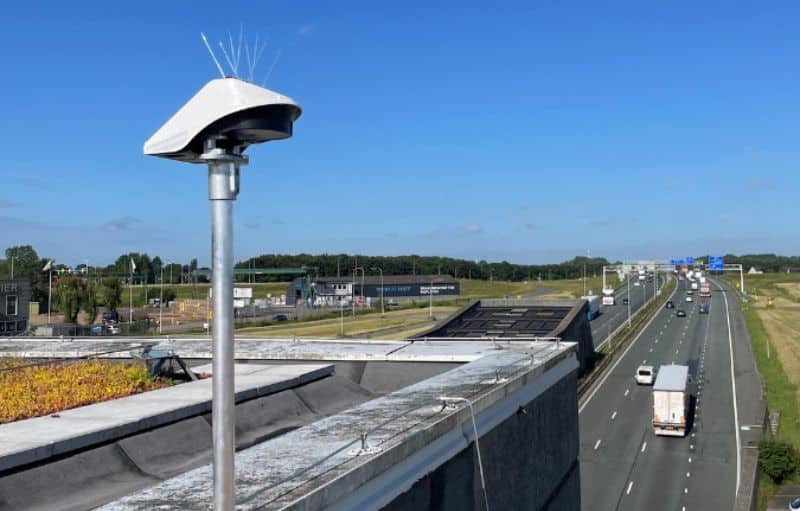
Monitoring of Tunnel Entrances – River Noord, Alblasserdam, Netherlands

Building Monitoring, Claes de Vrieselaan
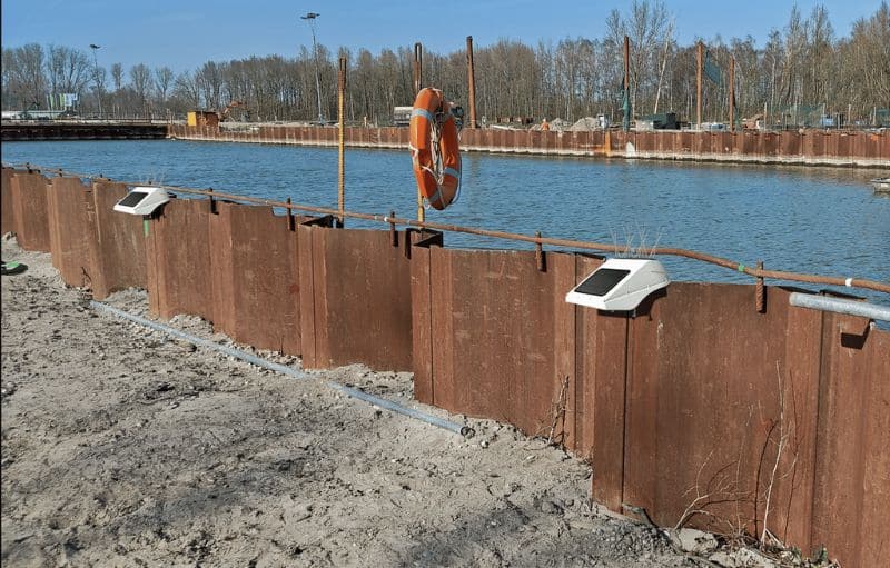
Sheet Pile Monitoring, A16 Rotterdam, NL
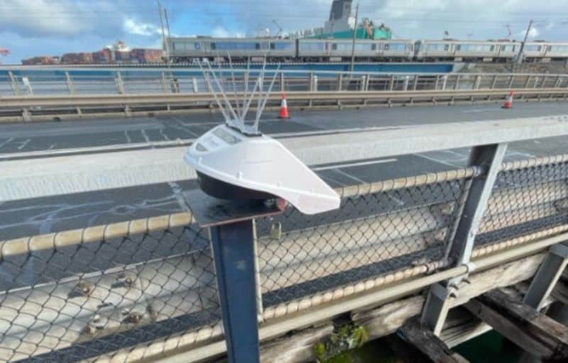
Fremantle Bridge Monitoring, Perth, Australia
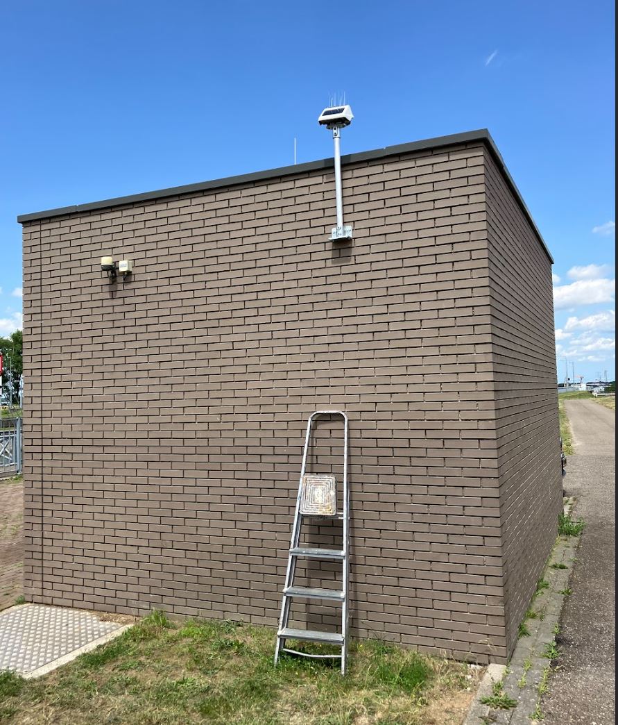
Deformation Monitoring at Maasbracht Lock, the Netherlands
Get in touch
We are ready to hear from you! Leave your details here, and your industry expert will be in touch soon.