Basetime: Precision Geodetic Solutions - Unlocking Excellence in geodetic data and tunnel construction.
The first Locator Ones placed at dike reinforcement Gorinchem–Waardenburg
Dike Reinforcement

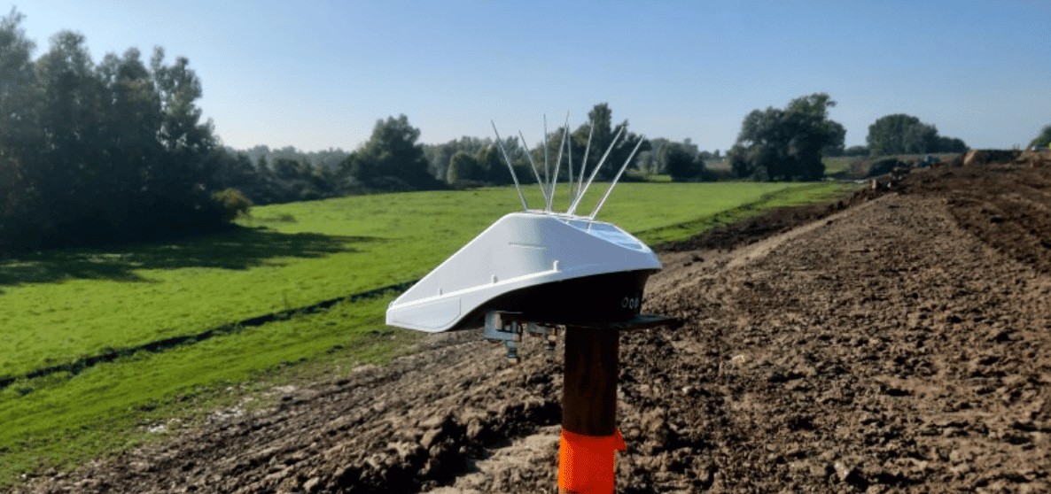
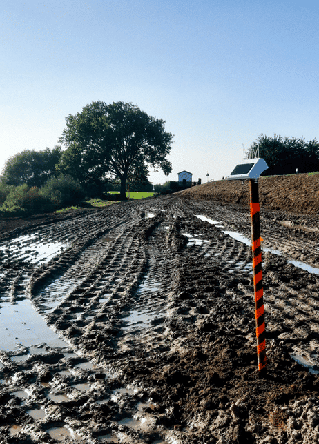
The time has come, the first 104 of a total of more than 200 Locator One devices have been installed on the Gorinchem – Waardenburg dike reinforcement project! Commissioned by the Waalensemble consortium (Heijmans, GMB, De Vries & van de Wiel and supported by advisor Royal Haskoning DHV) as part of the Graaf Reinald Alliance with client Waterschap Rivierenland, the monitoring of soil settlement will be carried out in the coming years in a smart and innovative way using Basetime’s Locator One.

Over the next five years, the dike between Gorinchem and Waardenburg will be raised, widened and reinforced over a total length of 23 kilometers. In order to maintain control over the embankments during construction, the body of the dike is normally measured by a surveyor. Due to the greasy clay soil, this is rigorous work and not completely without dangers such as collision and tripping hazards. Together with a desire for innovation, Locator One proved to be the ideal solution for this project.

How Locator One Works

The devices are mounted on the settlement rods and measure both the settlement of the base plate and the thickness of the appropriate ground body. The raw measurement data is received in our cloud environment, after which it is processed in Basetime’s calculation environment into reliable coordinates and other information that the geotechnical department needs. Finally, the data is linked via an API to the management system of the geotechnical department, where they can immediately analyze all information from behind their desk. By combining accurate data at a predefined time, the geotechnician is able to provide a more reliable prediction of expected settlements.
Dike Reinforcement

Consortium Waalensemble emphasizes on the importance of innovation and by choosing Locator One it reduces the travel needed on the project, thereby increasing safety and reducing CO2 emissions.

More information

Basetime provides you with reliable and securely collected data at the desired time. For more information, visit www.basetime.nl or get in touch via info@basetime.nl

For more information about the project Dijkversterking Gorinchem – Waardenburg, please visit www.gralliantie.nl.

Read more?

What’s new in Parvamoti? Part 3 of 3: View Movement Parallel and Perpendicular to Your Asset

For Object Monitoring projects, movement can now be viewed in relation to the actual direction of the asset.

By defining the Angle Linear Asset, Parvamoti can visualise displacement parallel and perpendicular to the structure, making it easier to understand whether movement is occurring along or across bridges, railways, roads and other linear assets.

A clearer way to interpret movement. More context for your monitoring data.

Lees meer

Part 3 of 3: View Movement Parallel and Perpendicular to Your Asset

INTERGEO 2026 recap: three days of monitoring in Munich

INTERGEO 2026 is a wrap!
We had three great days in Munich, meeting people from across the geospatial and monitoring industry and talking about projects, monitoring challenges and the possibilities of automated GNSS monitoring.

A big thank you to everyone who stopped by the Basetime booth.

Lees meer

barry, erik, martijn, koen en luna op intergeo 2026 in munchen

Introducing Alerts in Parvamoti

Monitoring shouldn’t mean continuously checking a dashboard to see whether something has changed.

With Alerts in Parvamoti, users can define relevant movement conditions and automatically notify the right people by email, SMS or both when those conditions are met.

That means less time spent manually checking monitoring dashboards, greater oversight of changing conditions and more focus on what happens next.

With the latest Alerts V2 update, we’ve expanded this functionality with more precise device targeting, new movement comparison options, clearer threshold guidance and a simpler configuration flow.

It’s another step towards our goal of making Parvamoti a more proactive monitoring platform, moving from reliable monitoring data towards timely information and action.

In our latest newsletter, we introduce Alerts in Parvamoti and take a closer look at what the new functionality offers.

Lees meer

alerts in parvamoti

What’s new in Parvamoti? – Part 2 of 3: Understand settlement relative to your project baseline

In the second part of our Parvamoti update series, we’re highlighting the 𝗥𝗲𝗹𝗮𝘁𝗶𝘃𝗲 𝗦𝗲𝘁𝘁𝗹𝗲𝗺𝗲𝗻𝘁 𝘃𝗶𝗲𝘄 𝘄𝗶𝘁𝗵𝗶𝗻 𝘁𝗵𝗲 𝗦𝗲𝘁𝘁𝗹𝗲𝗺𝗲𝗻𝘁 𝗥𝗼𝗱 𝗱𝗮𝘀𝗵𝗯𝗼𝗮𝗿𝗱.

This allows users to analyse soil level and ground plate height relative to the initial project baseline, making it easier to follow settlement development and recognise movement trends over time.

The dashboard also brings these measurements together visually, with the option to review individual measurements, averaged values and export the data for further analysis.

Read Part 2 to learn more about how Relative Settlement provides clearer context for settlement monitoring.

Lees meer