

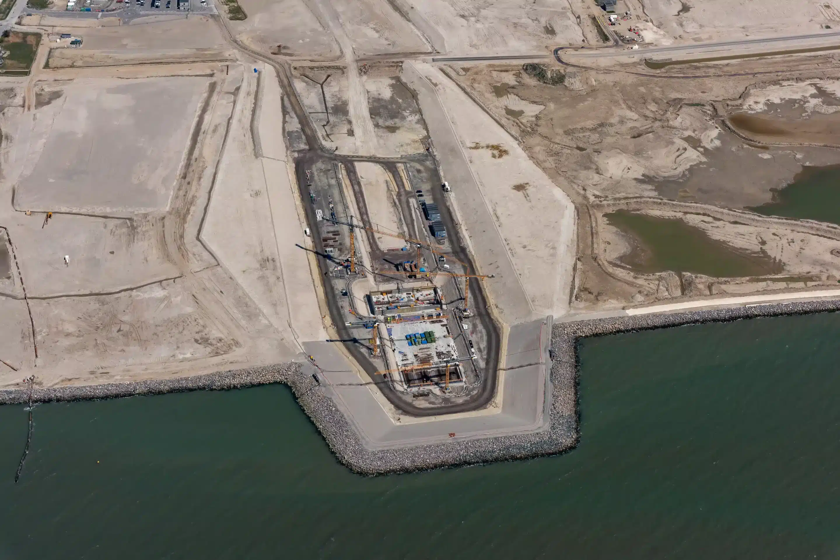
In 2011 both the Danish and German governments agreed on the construction of the Fehmarnbelt Tunnel. The tunnel, once completed the largest submerged construction ever built, has the aim of connecting the Danish Island of Lolland to the rest of mainland Europe. Lolland is a southern Danish Island connected to Zealand. This is the island that Copenhagen is situated on. Zealand, in its turn connects to Sweden’s capital Stockholm. This tunnel aims to improve the connection and traffic of Scandinavian countries to the rest of mainland Europe.
Integral parts of this project consist of the construction of large tunnel elements and the placement of these elements in the Fehmarnbelt strait. To do this safely, accurately, and efficiently, FLC (Femern Link Contractors, the joint venture in charge of the design and construction of the tunnel) has chosen Basetime’s Locator One 3D monitoring solution as a primary tool for the monitoring of the subsidence. In the first stage for the safety and contingency of the construction sites landside and then, after completion they will be deployed to ensure safety at sea. Read more about this project and the implementation of Basetime’s hardware and software, below.
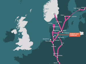
The Fehmarnbelt tunnel: the last missing link in the direct connection between Scandinavia and mainland Europe.
Who are FLC?
To put this use case and the size and complexity of this project into perspective, it is important to introduce our customer. Femern Link Contractors (FLC) consists of VINCI Constructions Grands Projets (France), Aarsleff (Denmark), Max Bögl Stiftung & CO KG (Germany), BAM Infra B.V (Holland), BAM International B.V (Holland), Wayss & Freytag Ingenieurbau AG (Germany), Solétanche-Bachy International S.A.S (France), CFE SA (Belgium), Dredging International NV (Belgium).
Why the Locator Ones?
We conducted an interview with FLC’s primary monitoring engineer, to gain insights into the reasons FLC opted for the Locator One’s and how they are being used right now, and how they will be deployed in later stages of the project.
One of the first questions we asked regarded the initial decision to use the Locator One. As it transpires, deploying the Locator One was actually a suggestion by a colleague working on another project also using Locator Ones to measure subsidence. After reviewing the challenges the other project faced and how Basetime’s devices were of great help, the decision was made to deploy Locator Ones on the building sites of the Fehmarnbelt Tunnel as they faced similar challenges.
The Locator Ones in practice
he Locator Ones used on the Fehmarnbelt Tunnel will have multiple uses. During this first stage, the Locator Ones will be used landside. Currently the project calls for the use of trail embankments, an extra body of ground, used to prepare the subsoil. To build on this soil, this preparation is necessary, otherwise the structure and its foundation will settle too much. Locator Ones are used to track the progress of this settlement and provide data, as to ensure the required settlement has been reached. Then, once they commence on building the dykes, Locator Ones will be place on the crest of these dykes. The Locator Ones will be used as a means to guarantee the height of these dykes, that if a storm occurs, the dykes will not take on water and the people working behind the dykes can do so safely.
Experiences with the Locator Ones so far
FLC currently have 77 active Locator Ones. In order to verify the accuracy of these devices, the data fed back from the Locator Ones were verified using manual measurements. After the data was proven to be of pinpoint precision, the remote nature of the device supports the manual handling. Because there is no need for manual measurements, using the Locator One saves time, energy and adds extra safety to the construction site.
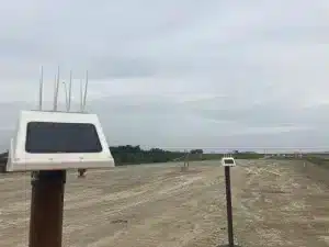
Moreover, Basetime’s flexibility in connecting the data is also a benefit to those working on the project. This is due to our variable data output source. Although we offer Basetime dashboards to receive data, we alternatively offer an API that allows the data to be sent to your own dashboards. Ideal for clients such as FLC as they have many different devices, all with their own dashboards, deployed on both the German and Danish side of the strait. Using Basetime’s API, all the data is sent directly to one overarching dashboard.
Basetime is also working towards the creation of a portal where users can edit the database and connections with other databases The portal is going to make it easier for engineers to add new Locator Ones to the databases and connect them to new objects in the database. This development would save monitoring engineers even more time and manual labour, as the usual method is that of transcribing data into Excel sheets.
Suitable for the largest submerged construction ever
FLC’s experience with the Locator Ones has so far been extremely positive. Aiding in the construction of the largest submerged construction on Earth, whilst consistently delivering accurate data.
We wish the FLC team all the best in the completion of the Fehmarnbelt Tunnel. As for our Locator Ones, if you could see the added value of the most precise, automated monitoring unit in your project, do not hesitate to reach out at info@basetime.nl.


