Continuous monitoring of tunnel behaviour.
Tunnels are critical links in our infrastructure. They carry traffic flows beneath urban areas, waterways, and mountain ranges. But like bridges, tunnels are not static structures. They respond to ground stresses, temperature variations, traffic loads, and settlement.
The question is not whether a tunnel moves.
The question is: do you recognise when its behaviour deviates from normal?
With the Locator Series, Basetime offers a scalable solution for both temporary project monitoring and permanent structural surveillance.
✓ Fewer site visits
✓ Lower operational costs
✓ Improved safety
✓ Full lifecycle coverage
Infrastructure is always moving. The question is: do you know when it shouldn’t be?
Every bridge, tunnel, and quay wall is continuously influenced by temperature, traffic, tides, wind, and time. Expansion, contraction, and displacement are normal. The real challenge is identifying subtle deviations in time that may indicate potential risk.
Traditional inspections and periodic measurements provide only a snapshot in time. As a result, subtle early warning signals often go unnoticed — even though these are precisely the signals that can prevent costly downtime or serious damage.
Our solutions
Two solutions. One integrated approach.
Basetime delivers two purpose-built GNSS systems for temporary measurements and permanent monitoring.
Locator One

Project-based monitoring
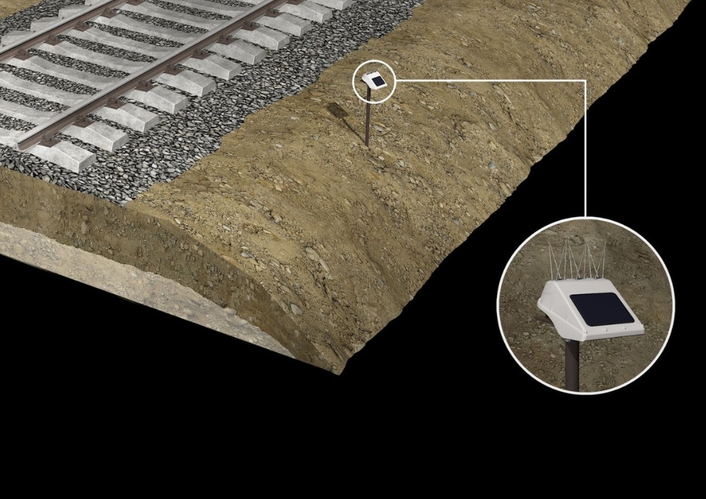
Autonomous GNSS monitoring for temporary or short-term measurements. Ideal for construction projects, surveying, and ground movement monitoring.
Locator Two

Continuous long-term monitoring
Permanent GNSS- and tilt-based monitoring for bridges, tunnels, railways, and other critical infrastructure, providing near real-time insight and automated alerts.

Insight into subtle movements
During maintenance activities or under the influence of ground stresses and temperature changes, tunnel elements can shift subtly relative to one another.
With the Locator Series, these movements become visible:
-
Detection of deviations from millimetre level
-
Recognition of trend changes in long-term measurement series
-
Insight into the influence of temperature on structural behaviour
-
Clear distinction between normal seasonal behaviour and structural deviation
This enables predictive maintenance instead of reactive intervention.

From measurement to action with Parvamoti
All measurement data is automatically transmitted to Parvamoti, Basetime’s cloud platform.
Here, GNSS, radar, and tilt data are:
-
Validated and analysed
-
Converted into clear visualisations
-
Compared with historical trends
-
Made available via API integrations
This gives asset managers continuous insight into the structural condition of their tunnels, without the need to interpret complex data.
Our applications
Designed for sectors where insight into movement is essential.
Basetime provides GNSS monitoring with sub-centimetre accuracy for construction teams, surveyors, and engineers, focused on the following applications:
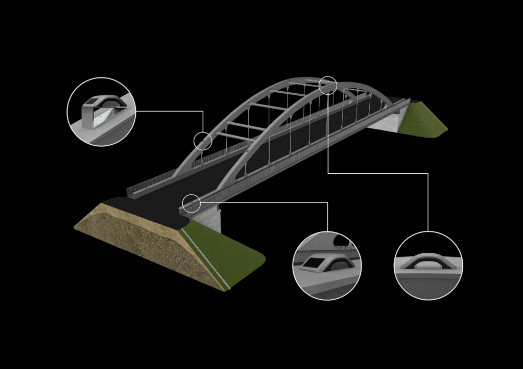
Bridge Monitoring
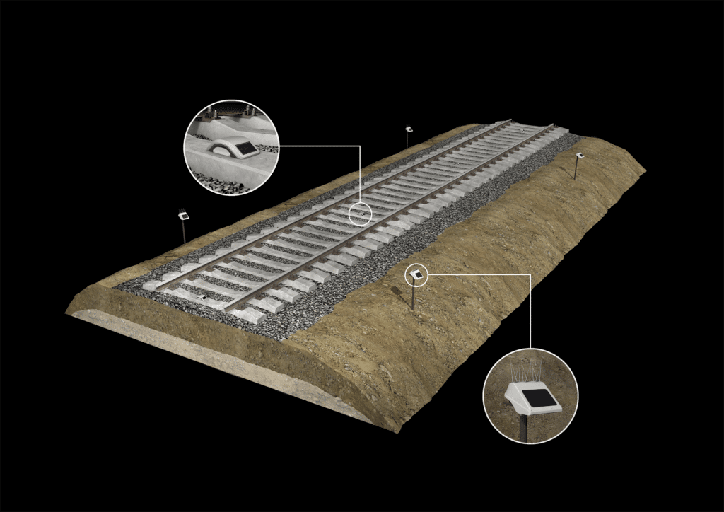
Railway monitoring
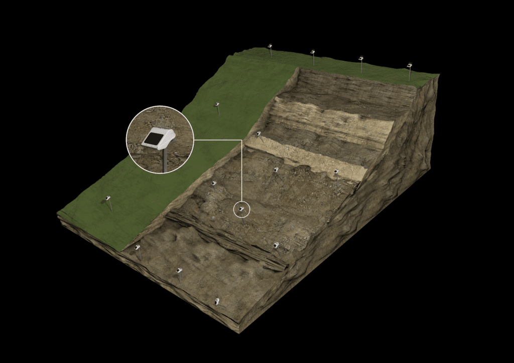
Landslide and slope stability monitoring
Water level and quay wall monitoring

Monitoring of critical infrastructure